Skip links

Cardo Maximus

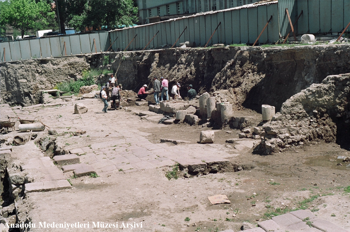
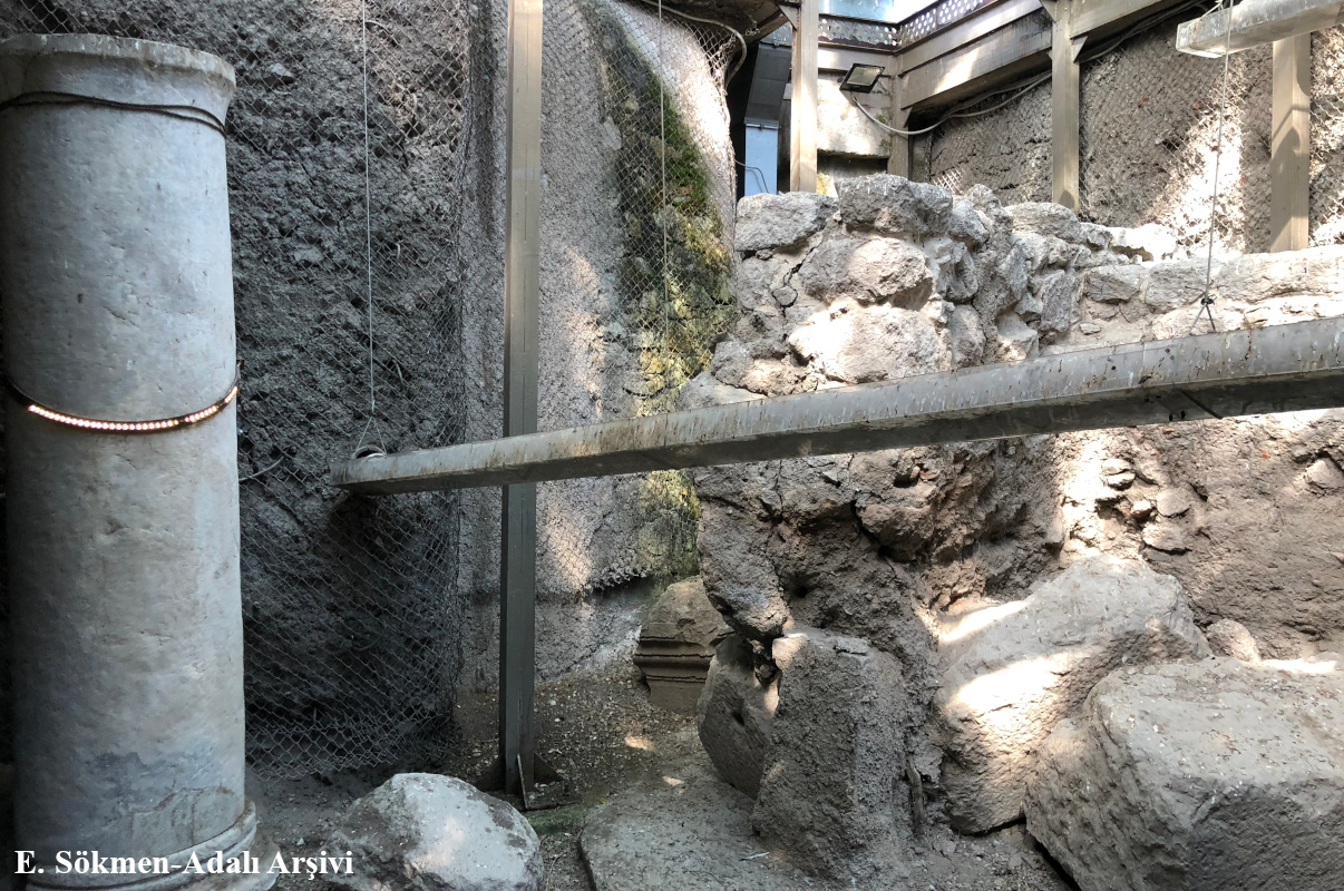
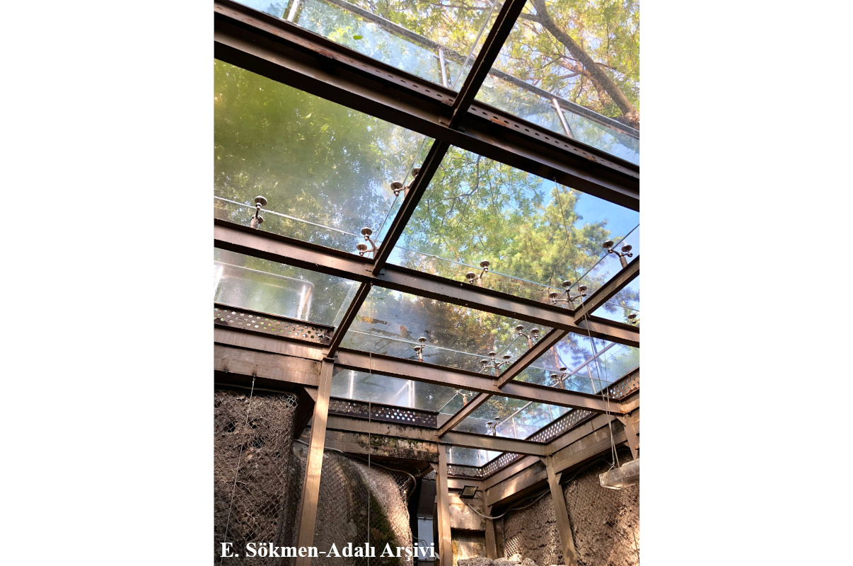
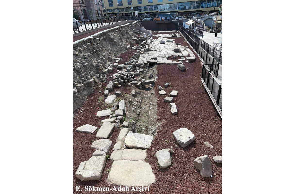
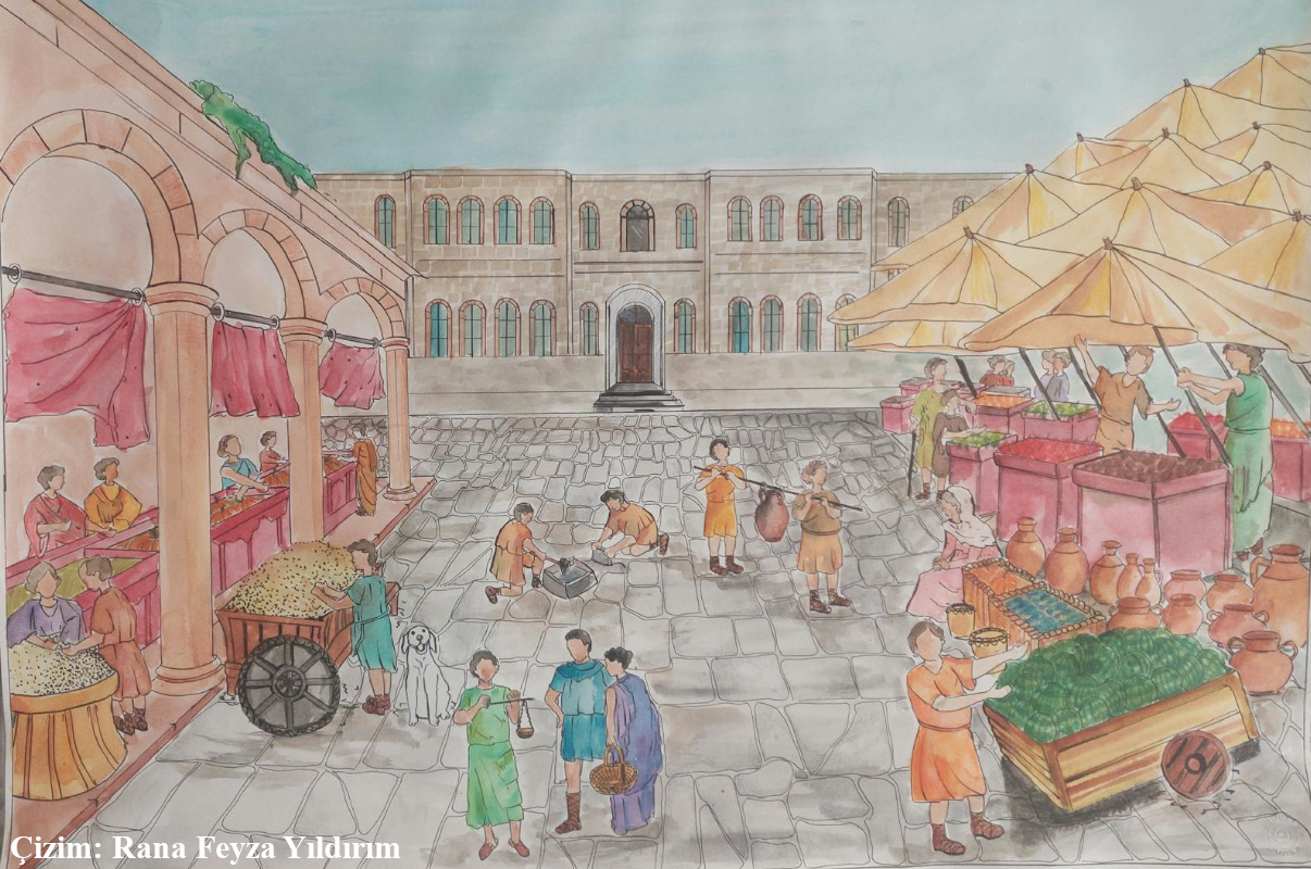
Ankyra (Ankara), the capital of the province of Galatia during the Roman period, became one of the significant centers of the Roman Empire in Anatolia due to its strategic location as well as its political, military, and economic roles. Positioned at a crucial junction connecting the eastern and western regions of the Empire, the city strengthened its military and commercial functions while also developing in line with Roman urban planning principles. The main artery of the city, known as the cardo maximus, was typically oriented in a north-south direction in Roman cities, serving as a central element in the urban plan and lying at the heart of commercial, social, and public life. Such streets, with their stone pavements, colonnaded walkways (stoas), and shops, provided both aesthetic and functional structures that facilitated daily life. The cardo maximus of Ankyra was uncovered in 1995 by experts from the Museum of Anatolian Civilizations and the Department of Classical Archaeology at Ankara University, Faculty of Language, History, and Geography. On the western side of the street, a stoa accompanied by a row of shops is present. The street, which measures 6.70 meters in width, was constructed with andesite blocks. Excavations have revealed a 55-meter section of the road, which is understood to extend towards Anafartalar Street and continue beneath the Old Governor’s Building. It was determined that the andesite blocks at the northern and southern ends of the street were largely lost, whereas the blocks in the central section were well preserved and displayed a polygonal (multi-sided) structure, differing from other sections. The street has a slight convex shape toward the east. Excavations in this direction revealed the presence of a waste water channel. It is probable that rainwater drainage was also facilitated by this channel. The eastern excavations also uncovered two threshold stones with traces of sliding doors. The direct connection of these stones to the street indicates the presence of a row of shops along the road. On the western side of the street, there is a colonnaded walkway (stoa) measuring 6.20 meters in width. The facade of the stoa was likely adorned with arcades, a possibility supported by the discovery of a profiled arch block during the street excavations. Archaeological findings suggest that the street, constructed with andesite blocks, may have been built no later than the 1st century AD.

References:

Kadıoğlu, M. (2011) Cardo Maximus, içinde: Roma Dönemi’nde Ankyra, der. M. Kadıoğlu, K. Görkay, S. Mitchell, Yapı Kredi Yayınları, İstanbul; 143-157.

Temizsoy, İ., M. Arslan, M. Akalın, M. Metin (1996) “Ulus Kazısı 1995”, Anadolu Medeniyetleri Müzesi 1995 Yıllığı, 7-19.

Photographs

The Section of the Cardo Maximus in Front of the Governor’s Office Building

During the construction of Ulus City Market, a section of the Cardo Maximus, the main north-south axis of the city during the Roman period, was uncovered. The northern extension of this street passes through the Social Sciences University of Ankara campus area and continues beneath the Governor’s Office Building. It is believed to intersect with the Colonnaded Street, which connected the Roman Bath to the Temple of Augustus. In 2007, archaeological excavations conducted in the front garden of the Governor’s Office revealed the multi-layered urban history of Ankara, spanning from the 1st century AD to the late 19th century.

At approximately 70 cm below the surface, a fill layer dating to the late 19th and early 20th centuries was documented. Beneath this layer, an 18th–19th century layer was identified, characterized by a dense concentration of ornamented clay pipes, glazed tiles, and porcelain fragments. As excavations continued, intersecting wall alignments extending in two different directions were uncovered. These two-phase walls were roughly dated to the 15th–17th centuries, corresponding to the Ottoman period. In the corner of the excavation area, a tandoor-oven structure contemporary with this architectural phase was also discovered.

At various depths within the fill layers spanning from the Ottoman to the Roman period, terracotta clean and waste water conduits were found. Additionally, an Ottoman-era sewer system with a manhole was uncovered, providing significant evidence of urban waste management during the Ottoman period. At a depth of 3.40 meters, Byzantine-period pottery fragments were identified, though they were not associated with any architectural remains. However, at a depth of 4.25 meters, Roman-period architectural elements and andesite pavement blocks belonging to the cardo were exposed. The excavations were carried out by archaeologists from the Anatolian Civilizations Museum Directorate, and the study was published by Mustafa Metin in the Anatolian Civilizations Museum 2007–2008 Annual Report.

This website uses cookies to improve your web experience.